


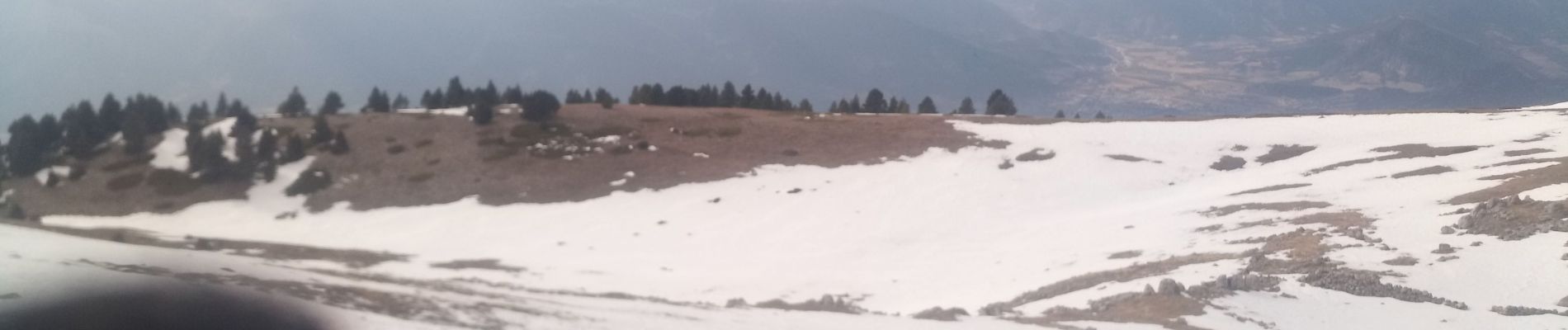
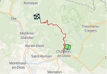
Chatillon en Diois - Abbaye de Valcroissant

Atchoum26
User

Length
17.9 km

Max alt
1951 m

Uphill gradient
1421 m
Km-Effort
37 km

Min alt
589 m

Downhill gradient
1353 m
Boucle
No
Creation date :
2022-02-13 06:32:23.331
Updated on :
2022-02-14 08:53:48.171
9h31
Difficulty : Difficult

FREE GPS app for hiking
 SityTrail
IGN / Geographical institutes
SityTrail Plus
The world is yours!
About
Trail Walking of 17.9 km to be discovered at Auvergne-Rhône-Alpes, Drôme, Châtillon-en-Diois. This trail is proposed by Atchoum26.
Photos


Positioning
Country:
France
Region :
Auvergne-Rhône-Alpes
Department/Province :
Drôme
Municipality :
Châtillon-en-Diois
Location:
Châtillon-en-Diois
Start:(Dec)
Start:(UTM)
696895 ; 4952103 (31T) N.
Comments