


exp_TMV BELFORT 2022.gpx

nicolas54230
User
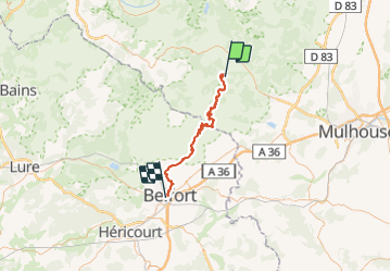

Length
48 km

Max alt
1081 m

Uphill gradient
1420 m
Km-Effort
68 km

Min alt
354 m

Downhill gradient
1796 m
Boucle
No
Creation date :
2022-02-14 09:27:09.294
Updated on :
2022-02-14 09:28:02.899
4h42
Difficulty : Very difficult

FREE GPS app for hiking
 SityTrail
IGN / Geographical institutes
SityTrail Plus
The world is yours!
About
Trail Mountain bike of 48 km to be discovered at Grand Est, Haut-Rhin, Moosch. This trail is proposed by nicolas54230.
Positioning
Country:
France
Region :
Grand Est
Department/Province :
Haut-Rhin
Municipality :
Moosch
Location:
Unknown
Start:(Dec)
Start:(UTM)
350534 ; 5300378 (32T) N.
Comments