Givry Le tour du bourg page 34

grasgilbert
User

Length
12.8 km

Max alt
300 m

Uphill gradient
173 m
Km-Effort
15.1 km

Min alt
195 m

Downhill gradient
174 m
Boucle
Yes
Creation date :
2022-02-14 14:01:56.868
Updated on :
2025-01-09 16:30:02.397
3h25
Difficulty : Difficult

FREE GPS app for hiking
 SityTrail
IGN / Geographical institutes
SityTrail Plus
The world is yours!
About
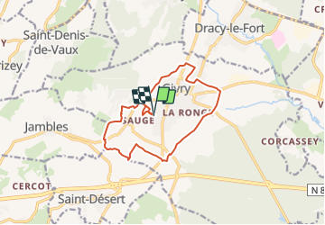
Trail Walking of 12.8 km to be discovered at Bourgogne-Franche-Comté, Saône-et-Loire, Givry. This trail is proposed by grasgilbert.
Positioning
Country:
France
Region :
Bourgogne-Franche-Comté
Department/Province :
Saône-et-Loire
Municipality :
Givry
Location:
Unknown
Start:(Dec)
Start:(UTM)
632429 ; 5181705 (31T) N.
Comments