


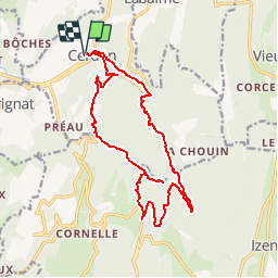
Les cascades du Cerdon

Sigmut
User

Length
17.2 km

Max alt
747 m

Uphill gradient
734 m
Km-Effort
27 km

Min alt
311 m

Downhill gradient
734 m
Boucle
Yes
Creation date :
2014-12-10 00:00:00.0
Updated on :
2019-04-06 21:59:47.348
5h29
Difficulty : Difficult

FREE GPS app for hiking
 SityTrail
IGN / Geographical institutes
SityTrail Plus
The world is yours!
About
Trail Walking of 17.2 km to be discovered at Auvergne-Rhône-Alpes, Ain, Cerdon. This trail is proposed by Sigmut.
Description
Très belle randonnée, variée et rafraîchissante
Positioning
Country:
France
Region :
Auvergne-Rhône-Alpes
Department/Province :
Ain
Municipality :
Cerdon
Location:
Unknown
Start:(Dec)
Start:(UTM)
690407 ; 5105879 (31T) N.
Comments