Trail On foot Bronckhorst - Keijenborg Route - Photo

Tous les sentiers balisés d’Europe GUIDE+
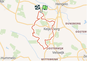
© OpenStreetMap contributors
Length
Length
11.9 km
Max alt
Max alt
18 m
Uphill gradient
Uphill gradient
40 m
Km-Effort
Km-Effort  
12.5 km
Min alt
Min alt
8 m
Downhill gradient
Downhill gradient
39 m
Boucle
Boucle
Yes
Signpost
Signpost
Creation date :
2022-02-14 15:29:29.746
Updated on :
2022-02-14 15:29:29.746

(0 Reviews)

On foot
On foot
2h50
Difficulty : Easy

Scan this QR Code to open this trail in the SityTrail application

FREE GPS app for hiking

Logo SityTrail SityTrail

IGN / Geographical institutes

Download SityTrail from the App Store Download SityTrail from Google Play

Logo SityTrail SityTrail Plus

The world is yours!

Download SityTrail from the App Store Download SityTrail from Google Play Download SityTrail on Huawei AppGallery

About

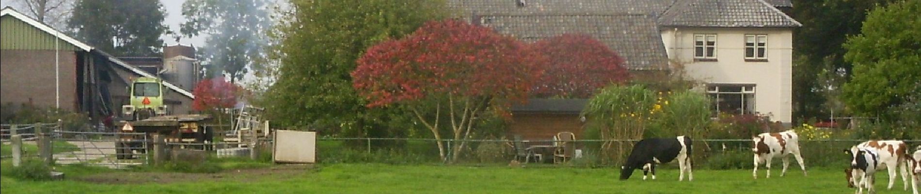
Trail On foot of 11.9 km to be discovered at Gelderland, Unknown, Bronckhorst. This trail is proposed by SityTrail - itinéraires balisés pédestres.

Description

De Achterhoek is dé regio voor wandel- en fietsliefhebbers. Je wordt bocht na bocht verrast. Ontdek hier de mooiste routes of plan je eigen route!

Website: http://www.achterhoekseroutes.nl/nl-nl/rd/dekeijenborgroute

Elevation profile

Photos

Positioning

Country:
Netherlands
Region :
Gelderland
Department/Province :
Unknown
Municipality :
Bronckhorst
Location:
Unknown
Start:(UTM)
313658 ; 5769443 (32U) N.


Close
My subscriptions