


tour du col du loup

jojo02
User
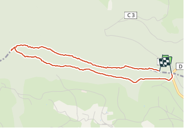

Length
4.4 km

Max alt
737 m

Uphill gradient
87 m
Km-Effort
5.6 km

Min alt
685 m

Downhill gradient
106 m
Boucle
Yes
Creation date :
2022-02-14 14:51:20.093
Updated on :
2022-02-14 16:06:00.279
1h14
Difficulty : Easy

FREE GPS app for hiking
 SityTrail
IGN / Geographical institutes
SityTrail Plus
The world is yours!
About
Trail Walking of 4.4 km to be discovered at Grand Est, Vosges, Mandray. This trail is proposed by jojo02.
Positioning
Country:
France
Region :
Grand Est
Department/Province :
Vosges
Municipality :
Mandray
Location:
Unknown
Start:(Dec)
Start:(UTM)
352095 ; 5340663 (32U) N.
Comments