


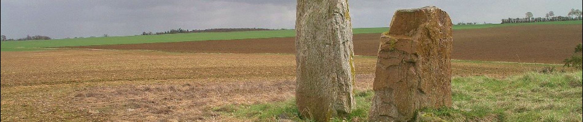
Circuit de la Brèche au Diable

SityTrail - itinéraires balisés pédestres
Tous les sentiers balisés d’Europe GUIDE+
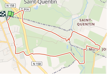

Length
5.8 km

Max alt
173 m

Uphill gradient
85 m
Km-Effort
7 km

Min alt
126 m

Downhill gradient
86 m
Boucle
Yes

Signpost
Creation date :
2022-02-15 04:31:39.29
Updated on :
2022-03-02 12:39:46.389
1h35
Difficulty : Easy

FREE GPS app for hiking
 SityTrail
IGN / Geographical institutes
SityTrail Plus
The world is yours!
About
Trail On foot of 5.8 km to be discovered at Normandy, Calvados, Potigny. This trail is proposed by SityTrail - itinéraires balisés pédestres.
Photos


Positioning
Country:
France
Region :
Normandy
Department/Province :
Calvados
Municipality :
Potigny
Location:
Unknown
Start:(Dec)
Start:(UTM)
701783 ; 5428281 (30U) N.
Comments