


les lacs de l'alpe d'huez

maupassant38
User
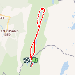

Length
6.9 km

Max alt
2093 m

Uphill gradient
172 m
Km-Effort
9.2 km

Min alt
2010 m

Downhill gradient
172 m
Boucle
Yes
Creation date :
2019-02-22 22:32:07.64
Updated on :
2019-02-22 22:32:07.655
2h11
Difficulty : Unknown

FREE GPS app for hiking
 SityTrail
IGN / Geographical institutes
SityTrail Plus
The world is yours!
About
Trail Walking of 6.9 km to be discovered at Auvergne-Rhône-Alpes, Isère, Huez. This trail is proposed by maupassant38.
Positioning
Country:
France
Region :
Auvergne-Rhône-Alpes
Department/Province :
Isère
Municipality :
Huez
Location:
Unknown
Start:(Dec)
Start:(UTM)
270826 ; 4999899 (32T) N.
Comments