Trail On foot Saorge - Croix du mont Agu - Photo

Tous les sentiers balisés d’Europe PRO

© OpenStreetMap contributors
Length
Length
9.9 km
Max alt
Max alt
1074 m
Uphill gradient
Uphill gradient
982 m
Km-Effort
Km-Effort  
23 km
Min alt
Min alt
337 m
Downhill gradient
Downhill gradient
971 m
Boucle
Boucle
Yes
Signpost
Signpost
Creation date :
2022-02-15 18:39:22.899
Updated on :
2022-03-02 21:24:07.327

(0 Reviews)

On foot
On foot
5h12
Difficulty : Medium

Scan this QR Code to open this trail in the SityTrail application

FREE GPS app for hiking

Logo SityTrail SityTrail

IGN / Geographical institutes

Download SityTrail from the App Store Download SityTrail from Google Play

Logo SityTrail SityTrail World

The world is yours!

Download SityTrail from the App Store Download SityTrail from Google Play Download SityTrail on Huawei AppGallery

About

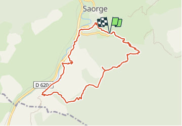
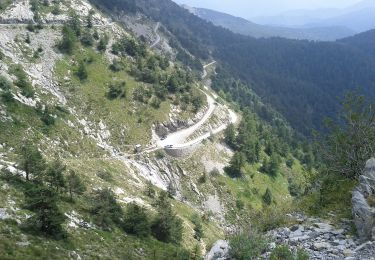
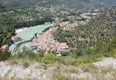
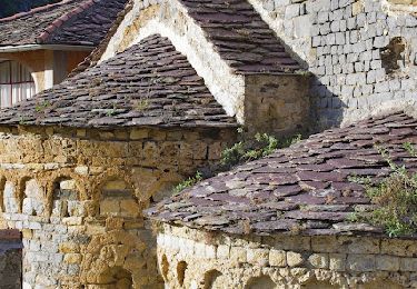
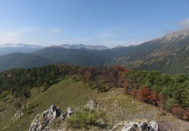
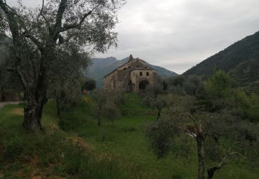
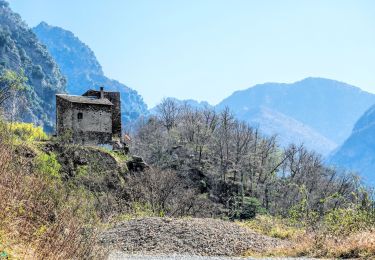
Trail On foot of 9.9 km to be discovered at Provence-Alpes-Côte d'Azur, Maritime Alps, Saorge. This trail is proposed by SityTrail - itinéraires balisés pédestres.

Description

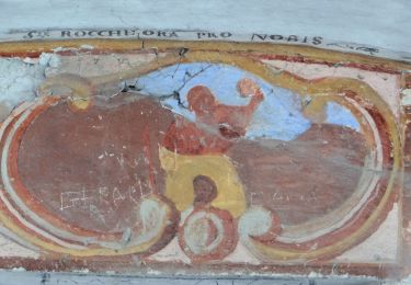
Randonnée pédestre - Au départ de Saorge, sanctuaire de la Madone de Poggio (480 m)

Website: https://randoxygene.departement06.fr/roya/croix-du-mont-agu-9398.html

Photos

Positioning

Country:
France
Region :
Provence-Alpes-Côte d'Azur
Department/Province :
Maritime Alps
Municipality :
Saorge
Location:
Unknown
Start:(UTM)
384266 ; 4870911 (32T) N.

Trails nearby

Trail On foot Saorge - Château fort de Malmort - Photo
On foot
PRO

On foot

Easy
Saorge, Provence-Alpes-Côte d'Azur, Maritime Alps, France
6.5 km | 14.8 km-effort
3h 22min
Yes
Trail On foot Fontan - Hameaux de Bergue - Photo
On foot
PRO

On foot

Medium
Fontan, Provence-Alpes-Côte d'Azur, Maritime Alps, France
13.6 km | 24 km-effort
5h 27min
Yes
Trail On foot Saorge - Circuit de Peiremont - Photo
On foot
PRO

On foot

Easy
Saorge, Provence-Alpes-Côte d'Azur, Maritime Alps, France
7.6 km | 14.8 km-effort
3h 21min
Yes
Trail On foot Pigna - Colle Scarassan - Sella d'Agnaira - Photo
On foot
PRO

On foot

Medium
Pigna, Liguria, Imperia, Italy
11.8 km | 22 km-effort
5h 5min
No
Trail Walking Breil-sur-Roya - Breuil sur Roya. col de Brouis. Tour de la cime du Bosc.  - Photo
Walking
ged94

Walking

Medium
Breil-sur-Roya, Provence-Alpes-Côte d'Azur, Maritime Alps, France
15 km | 25 km-effort
8h 0min
Yes
Trail Walking Saorge - Circuit Saorge Chapelles Stes croix et Anne Col de Peïremont - Photo
Walking
GrouGary

Walking

Medium
Saorge, Provence-Alpes-Côte d'Azur, Maritime Alps, France
11.1 km | 21 km-effort
2h 59min
No
Trail Walking Fontan - Berghe - Cime Corvo - Photo
Walking
aris

Walking

Easy
Fontan, Provence-Alpes-Côte d'Azur, Maritime Alps, France
10.7 km | 19.3 km-effort
3h 45min
Yes
Trail Walking Breil-sur-Roya - col d annon - Photo
Walking
montagne06

Walking

Difficult
Breil-sur-Roya, Provence-Alpes-Côte d'Azur, Maritime Alps, France
19.2 km | 33 km-effort
6h 30min
No
Trail Walking Saorge - Pont de Castou Vallon  de la Bendola  - Photo
Walking
jlrayon

Walking

Easy
Saorge, Provence-Alpes-Côte d'Azur, Maritime Alps, France
8.9 km | 13.1 km-effort
4h 18min
Yes


Close
My subscriptions