


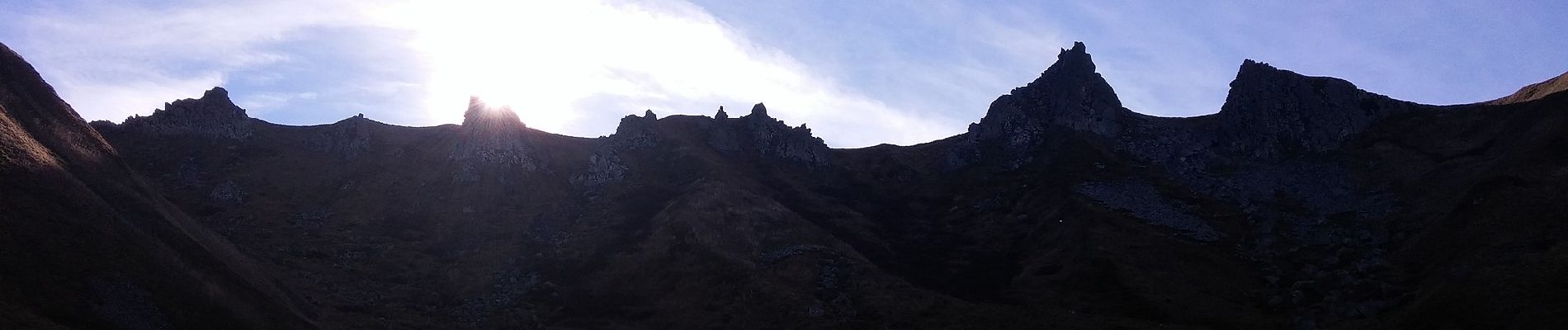
Le Puy de Sancy

SityTrail - itinéraires balisés pédestres
Tous les sentiers balisés d’Europe GUIDE+
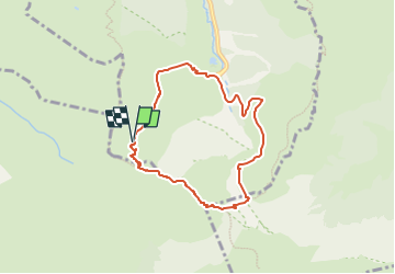

Length
6.9 km

Max alt
1862 m

Uphill gradient
534 m
Km-Effort
14 km

Min alt
1321 m

Downhill gradient
525 m
Boucle
Yes

Signpost
Creation date :
2022-02-15 18:57:10.89
Updated on :
2022-03-02 22:16:57.2
3h10
Difficulty : Easy

FREE GPS app for hiking
 SityTrail
IGN / Geographical institutes
SityTrail Plus
The world is yours!
About
Trail On foot of 6.9 km to be discovered at Auvergne-Rhône-Alpes, Puy-de-Dôme, Mont-Dore. This trail is proposed by SityTrail - itinéraires balisés pédestres.
Description
Trail created by CD63.
Photos


Positioning
Country:
France
Region :
Auvergne-Rhône-Alpes
Department/Province :
Puy-de-Dôme
Municipality :
Mont-Dore
Location:
Unknown
Start:(Dec)
Start:(UTM)
484648 ; 5042373 (31T) N.
Comments