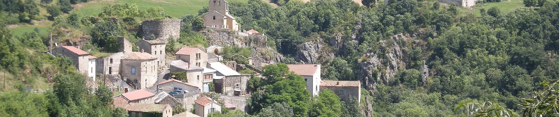
La Vallee des Saints

SityTrail - itinéraires balisés pédestres
Tous les sentiers balisés d’Europe GUIDE+
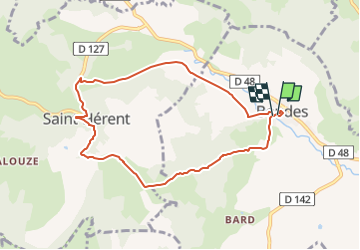

Length
8.1 km

Max alt
628 m

Uphill gradient
221 m
Km-Effort
11.1 km

Min alt
461 m

Downhill gradient
219 m
Boucle
Yes

Signpost
Creation date :
2022-02-15 19:12:13.262
Updated on :
2022-03-02 23:12:49.554
2h31
Difficulty : Easy

FREE GPS app for hiking
 SityTrail
IGN / Geographical institutes
SityTrail Plus
The world is yours!
About
Trail On foot of 8.1 km to be discovered at Auvergne-Rhône-Alpes, Puy-de-Dôme, Boudes. This trail is proposed by SityTrail - itinéraires balisés pédestres.
Description
Trail created by CD63.
Photos


Positioning
Country:
France
Region :
Auvergne-Rhône-Alpes
Department/Province :
Puy-de-Dôme
Municipality :
Boudes
Location:
Unknown
Start:(Dec)
Start:(UTM)
514407 ; 5033889 (31T) N.
Comments