


SityTrail - 2428982 - grp-luberon-tour-des-clapaedes-42km

thonyc
User GUIDE
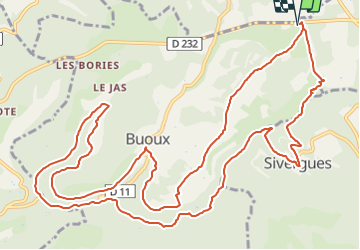

Length
17.7 km

Max alt
574 m

Uphill gradient
427 m
Km-Effort
23 km

Min alt
353 m

Downhill gradient
427 m
Boucle
Yes
Creation date :
2022-02-17 09:28:41.684
Updated on :
2022-02-17 10:11:24.567
5h40
Difficulty : Difficult

FREE GPS app for hiking
 SityTrail
IGN / Geographical institutes
SityTrail Plus
The world is yours!
About
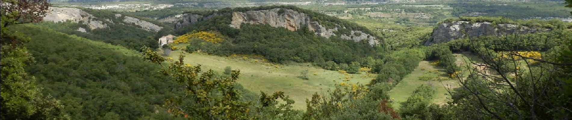
Trail Walking of 17.7 km to be discovered at Provence-Alpes-Côte d'Azur, Vaucluse, Buoux. This trail is proposed by thonyc.
Photos


Positioning
Country:
France
Region :
Provence-Alpes-Côte d'Azur
Department/Province :
Vaucluse
Municipality :
Buoux
Location:
Unknown
Start:(Dec)
Start:(UTM)
693201 ; 4857521 (31T) N.
Comments