


Châteaux d'Ottrot

PhilippeC54
User

Length
10.6 km

Max alt
716 m

Uphill gradient
468 m
Km-Effort
16.9 km

Min alt
248 m

Downhill gradient
470 m
Boucle
Yes
Creation date :
2022-02-17 12:38:43.138
Updated on :
2022-02-17 16:02:58.814
2h56
Difficulty : Medium

FREE GPS app for hiking
 SityTrail
IGN / Geographical institutes
SityTrail Plus
The world is yours!
About
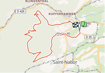
Trail Walking of 10.6 km to be discovered at Grand Est, Bas-Rhin, Ottrott. This trail is proposed by PhilippeC54.
Positioning
Country:
France
Region :
Grand Est
Department/Province :
Bas-Rhin
Municipality :
Ottrott
Location:
Unknown
Start:(Dec)
Start:(UTM)
384154 ; 5368403 (32U) N.
Comments