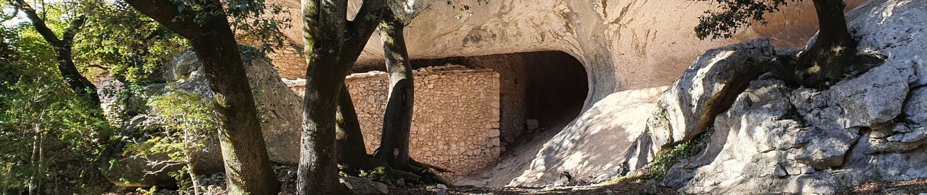
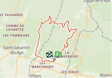
Les Aiguiers du Villars par Cabrone

MarcLEBARON
User

Length
17.7 km

Max alt
807 m

Uphill gradient
694 m
Km-Effort
27 km

Min alt
312 m

Downhill gradient
696 m
Boucle
Yes
Creation date :
2022-02-18 07:15:53.188
Updated on :
2022-02-26 17:48:20.45
4h36
Difficulty : Difficult

FREE GPS app for hiking
 SityTrail
IGN / Geographical institutes
SityTrail Plus
The world is yours!
About
Trail Walking of 17.7 km to be discovered at Provence-Alpes-Côte d'Azur, Vaucluse, Villars. This trail is proposed by MarcLEBARON.
Description
La difficulté réside essentiellement au dénivelé qui se fait dans les premiers kilomètres.
Photos


Positioning
Country:
France
Region :
Provence-Alpes-Côte d'Azur
Department/Province :
Vaucluse
Municipality :
Villars
Location:
Unknown
Start:(Dec)
Start:(UTM)
694723 ; 4867526 (31T) N.
Comments