


le tour du Mont vinaigre

pln30
User
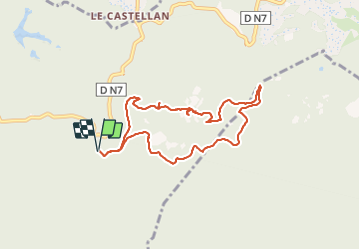

Length
8.2 km

Max alt
600 m

Uphill gradient
302 m
Km-Effort
12.2 km

Min alt
337 m

Downhill gradient
302 m
Boucle
Yes
Creation date :
2022-02-20 10:38:20.778
Updated on :
2022-02-20 14:06:45.277
2h27
Difficulty : Easy

FREE GPS app for hiking
 SityTrail
IGN / Geographical institutes
SityTrail Plus
The world is yours!
About
Trail Walking of 8.2 km to be discovered at Provence-Alpes-Côte d'Azur, Var, Fréjus. This trail is proposed by pln30.
Description
promenade facile, pour profiter de magnifiques paysages, à faire par grand beau temps. courant mars 2022, vous pourrez voir cette rando avec des plans drone, sur ma chaîne youtube. Air View Channel
Positioning
Country:
France
Region :
Provence-Alpes-Côte d'Azur
Department/Province :
Var
Municipality :
Fréjus
Location:
Unknown
Start:(Dec)
Start:(UTM)
322540 ; 4818387 (32T) N.
Comments