


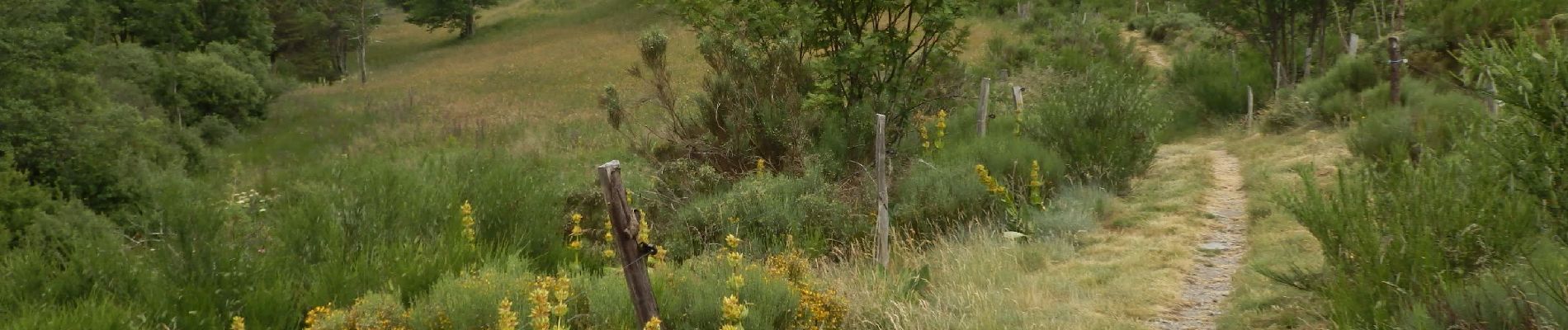
Etape1 Cévenne ardéchoise 17km

thonyc
User GUIDE

Length
19.4 km

Max alt
1211 m

Uphill gradient
800 m
Km-Effort
31 km

Min alt
513 m

Downhill gradient
980 m
Boucle
No
Creation date :
2022-02-22 07:50:47.122
Updated on :
2022-02-22 10:28:30.882
6h00
Difficulty : Difficult

FREE GPS app for hiking
 SityTrail
IGN / Geographical institutes
SityTrail Plus
The world is yours!
About
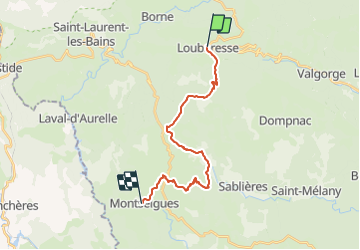
Trail Walking of 19.4 km to be discovered at Auvergne-Rhône-Alpes, Ardèche, Loubaresse. This trail is proposed by thonyc.
Photos


Positioning
Country:
France
Region :
Auvergne-Rhône-Alpes
Department/Province :
Ardèche
Municipality :
Loubaresse
Location:
Unknown
Start:(Dec)
Start:(UTM)
583358 ; 4939071 (31T) N.
Comments