


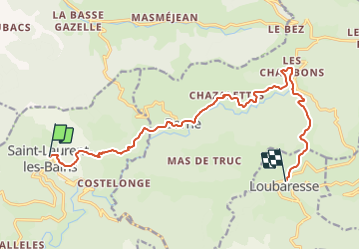
Etape3 Cévenne ardéchoise 17km

thonyc
User GUIDE

Length
14.3 km

Max alt
1372 m

Uphill gradient
876 m
Km-Effort
25 km

Min alt
849 m

Downhill gradient
505 m
Boucle
No
Creation date :
2022-02-22 08:00:47.423
Updated on :
2022-02-22 10:32:40.43
5h30
Difficulty : Difficult

FREE GPS app for hiking
 SityTrail
IGN / Geographical institutes
SityTrail Plus
The world is yours!
About
Trail Walking of 14.3 km to be discovered at Auvergne-Rhône-Alpes, Ardèche, Saint-Laurent-les-Bains-Laval-d'Aurelle. This trail is proposed by thonyc.
Description
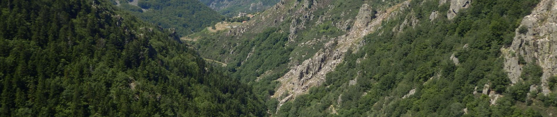
Superbe parcours avec la remontée de la vallée de La borne
Photos


Positioning
Country:
France
Region :
Auvergne-Rhône-Alpes
Department/Province :
Ardèche
Municipality :
Saint-Laurent-les-Bains-Laval-d'Aurelle
Location:
Saint-Laurent-les-Bains
Start:(Dec)
Start:(UTM)
576927 ; 4939746 (31T) N.
Comments