


22 02 2022 phili eric

Tommy Eric
User
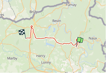

Length
38 km

Max alt
388 m

Uphill gradient
763 m
Km-Effort
48 km

Min alt
132 m

Downhill gradient
711 m
Boucle
No
Creation date :
2022-02-22 14:08:33.972
Updated on :
2022-02-23 14:01:49.455
3h24
Difficulty : Very difficult

FREE GPS app for hiking
 SityTrail
IGN / Geographical institutes
SityTrail Plus
The world is yours!
About
Trail Walking of 38 km to be discovered at Grand Est, Ardennes, Bogny-sur-Meuse. This trail is proposed by Tommy Eric.
Description
Ardoisière Les Vannelles
Photos

Positioning
Country:
France
Region :
Grand Est
Department/Province :
Ardennes
Municipality :
Bogny-sur-Meuse
Location:
Unknown
Start:(Dec)
Start:(UTM)
624236 ; 5524880 (31U) N.
Comments