Trail Nordic walking Jarrie - Reconnaissance d'une MN au départ du Château de Bon Repos - Photo

Reconnaissance d'une MN au départ du Château de Bon Repos

 Emelle
Emelle

User

© OpenStreetMap contributors
Length
Length
9.9 km
Max alt
Max alt
443 m
Uphill gradient
Uphill gradient
308 m
Km-Effort
Km-Effort  
14.1 km
Min alt
Min alt
265 m
Downhill gradient
Downhill gradient
310 m
Boucle
Boucle
Yes
Creation date :
2022-02-24 08:20:27.656
Updated on :
2022-03-09 14:01:55.943

(1 Reviews)

Nordic walking
Nordic walking
3h31
Difficulty : Easy

Scan this QR Code to open this trail in the SityTrail application

FREE GPS app for hiking

Logo SityTrail SityTrail

IGN / Geographical institutes

Download SityTrail from the App Store Download SityTrail from Google Play

Logo SityTrail SityTrail World

The world is yours!

Download SityTrail from the App Store Download SityTrail from Google Play Download SityTrail on Huawei AppGallery

About

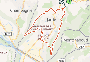
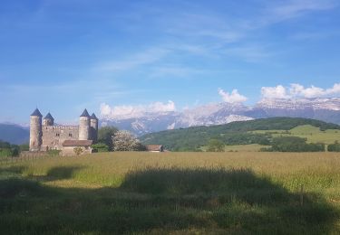
Trail Nordic walking of 9.9 km to be discovered at Auvergne-Rhône-Alpes, Isère, Jarrie. This trail is proposed by Emelle.

Description

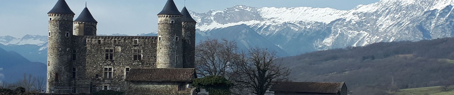
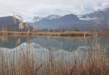
Une marche nordique qui permet de découvrir le château de Bon Repas et le Clos Jouvin avec son parc et ses arbres remarquables.
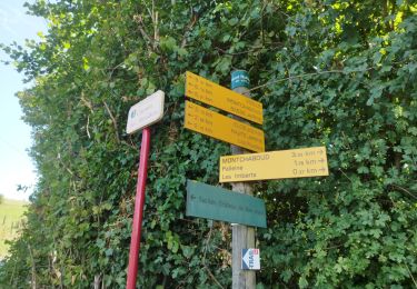
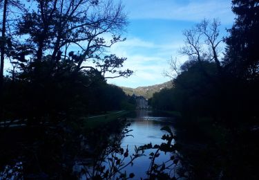
Le retour par le Saut du Moine permet de faire un circuit complet.
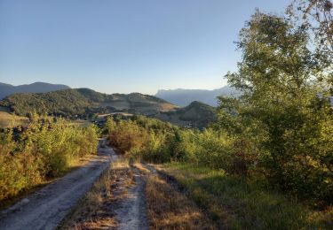
Une seule portion un peu raide à la descente qui doit pouvoir être contourner (à vérifier).

Elevation profile

Photos

Positioning

Country:
France
Region :
Auvergne-Rhône-Alpes
Department/Province :
Isère
Municipality :
Jarrie
Location:
Unknown
Start:(UTM)
716968 ; 4999043 (31T) N.

Comments

Please log in to post a review or rate the element


Trails nearby

Trail Running Vizille - Echappée Belle 2013 - Photo
Running
micleo66

Running

Very difficult
(1)
Vizille, Auvergne-Rhône-Alpes, Isère, France
136 km | 279 km-effort
60h 0min
No
Trail Walking Champ-sur-Drac - 38 Couvent St Michel Champ / drac - Photo
Walking
ericf64

Walking

Medium
Champ-sur-Drac, Auvergne-Rhône-Alpes, Isère, France
9.4 km | 19.7 km-effort
3h 0min
Yes
Trail Walking Varces-Allières-et-Risset - Les Etangs de Reymure réaménagés en 2023. - Photo
Walking
patjobou

Walking

Medium
Varces-Allières-et-Risset, Auvergne-Rhône-Alpes, Isère, France
7.9 km | 8.6 km-effort
2h 35min
Yes
Trail Nordic walking Jarrie - Mon chabou -haut jarret  - Photo
Nordic walking
Youcef Atallah

Nordic walking

Very easy
Jarrie, Auvergne-Rhône-Alpes, Isère, France
10.2 km | 14.6 km-effort
2h 21min
Yes
Trail Walking Brié-et-Angonnes - Brié - Montchabout - Sommet de Pravena - Photo
Walking
flip38

Walking

Medium
Brié-et-Angonnes, Auvergne-Rhône-Alpes, Isère, France
14.5 km | 23 km-effort
4h 19min
Yes
Trail Walking Brié-et-Angonnes - Brié- Table d'orientation  - Photo
Walking
crocau

Walking

Very easy
Brié-et-Angonnes, Auvergne-Rhône-Alpes, Isère, France
3.1 km | 4.3 km-effort
59min
Yes
Trail Nordic walking Jarrie - Château de Bon Repos, Bois de Bouchassey, Saut du Moine - Photo
Nordic walking
patjobou

Nordic walking

Easy
Jarrie, Auvergne-Rhône-Alpes, Isère, France
9.6 km | 13.7 km-effort
2h 18min
Yes
Trail On foot Herbeys - Les Quatre Seigneurs - Photo
On foot
PRO

On foot

Easy
Herbeys, Auvergne-Rhône-Alpes, Isère, France
4.8 km | 7.9 km-effort
1h 48min
No
Trail Nordic walking Vizille - Circuit en MN dans le parc de Vizille - Photo
Nordic walking
Emelle

Nordic walking

Easy
Vizille, Auvergne-Rhône-Alpes, Isère, France
7.8 km | 8.8 km-effort
2h 49min
Yes


Close
My subscriptions