


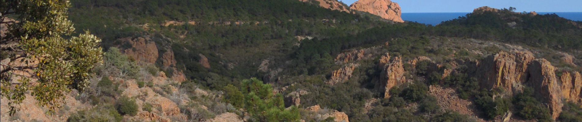
de L'Esterel au rastel

pln30
User
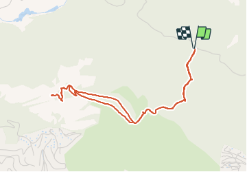

Length
5.1 km

Max alt
266 m

Uphill gradient
166 m
Km-Effort
7.3 km

Min alt
126 m

Downhill gradient
166 m
Boucle
Yes
Creation date :
2022-02-27 11:45:12.701
Updated on :
2022-02-27 13:32:49.53
1h47
Difficulty : Easy

FREE GPS app for hiking
 SityTrail
IGN / Geographical institutes
SityTrail Plus
The world is yours!
About
Trail Walking of 5.1 km to be discovered at Provence-Alpes-Côte d'Azur, Var, Saint-Raphaël. This trail is proposed by pln30.
Description
promenade sans grande difficulté pour aller de l'intérieur de L'Esterel, jusqu'à la table d'orientation du rastel
Photos


Positioning
Country:
France
Region :
Provence-Alpes-Côte d'Azur
Department/Province :
Var
Municipality :
Saint-Raphaël
Location:
Unknown
Start:(Dec)
Start:(UTM)
328822 ; 4812728 (32T) N.
Comments