


Mont Falourde de Bairols

franquen
User
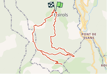

Length
12.6 km

Max alt
1282 m

Uphill gradient
639 m
Km-Effort
21 km

Min alt
786 m

Downhill gradient
646 m
Boucle
Yes
Creation date :
2022-02-28 09:40:44.407
Updated on :
2022-02-28 14:22:00.723
4h40
Difficulty : Medium

FREE GPS app for hiking
 SityTrail
IGN / Geographical institutes
SityTrail Plus
The world is yours!
About
Trail Walking of 12.6 km to be discovered at Provence-Alpes-Côte d'Azur, Maritime Alps, Bairols. This trail is proposed by franquen.
Positioning
Country:
France
Region :
Provence-Alpes-Côte d'Azur
Department/Province :
Maritime Alps
Municipality :
Bairols
Location:
Unknown
Start:(Dec)
Start:(UTM)
349620 ; 4871733 (32T) N.
Comments