


combe de Mont Rond

CABERMAT
User

Length
88 km

Max alt
2330 m

Uphill gradient
1760 m
Km-Effort
115 km

Min alt
244 m

Downhill gradient
2758 m
Boucle
No
Creation date :
2022-03-01 08:00:24.997
Updated on :
2022-03-01 15:56:13.344
7h53
Difficulty : Very easy

FREE GPS app for hiking
 SityTrail
IGN / Geographical institutes
SityTrail Plus
The world is yours!
About
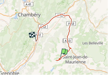
Trail Touring skiing of 88 km to be discovered at Auvergne-Rhône-Alpes, Savoy, Saint-Colomban-des-Villards. This trail is proposed by CABERMAT.
Positioning
Country:
France
Region :
Auvergne-Rhône-Alpes
Department/Province :
Savoy
Municipality :
Saint-Colomban-des-Villards
Location:
Unknown
Start:(Dec)
Start:(UTM)
281052 ; 5018249 (32T) N.
Comments