


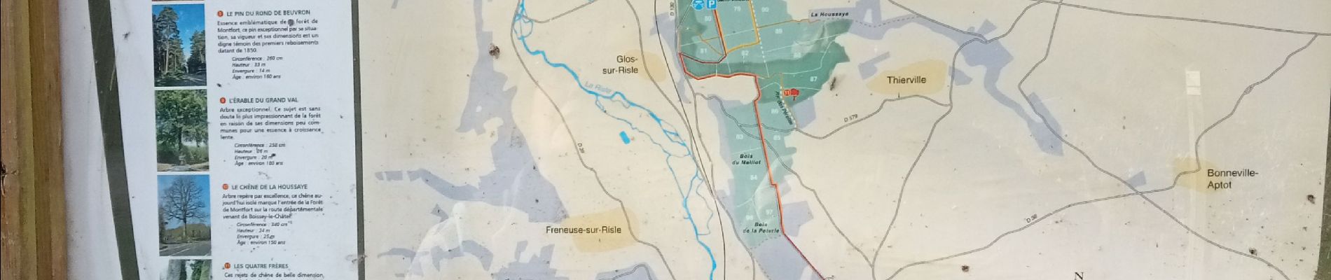
Cauverville en Roumois - Le chemin du chênede la Vierge

MichelRando7656
User
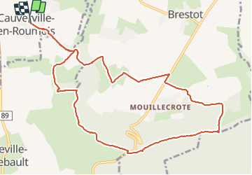

Length
11.7 km

Max alt
139 m

Uphill gradient
171 m
Km-Effort
13.9 km

Min alt
52 m

Downhill gradient
174 m
Boucle
Yes
Creation date :
2022-03-02 13:16:41.321
Updated on :
2022-03-02 16:23:25.063
3h06
Difficulty : Difficult

FREE GPS app for hiking
 SityTrail
IGN / Geographical institutes
SityTrail Plus
The world is yours!
About
Trail Walking of 11.7 km to be discovered at Normandy, Eure, Cauverville-en-Roumois. This trail is proposed by MichelRando7656.
Description
Parcours composé de petites routes avec de de belles maisons, de chemins rocailleux mais essentiellement herbeux
Photos


Positioning
Country:
France
Region :
Normandy
Department/Province :
Eure
Municipality :
Cauverville-en-Roumois
Location:
Unknown
Start:(Dec)
Start:(UTM)
329138 ; 5469135 (31U) N.
Comments
