


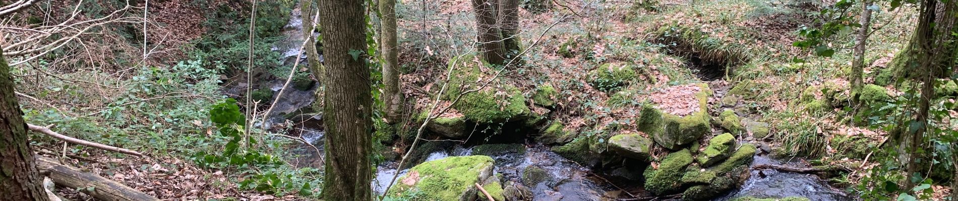
Ruisseau du Ser

cedric.fargues
User
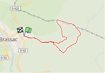

Length
4.8 km

Max alt
743 m

Uphill gradient
282 m
Km-Effort
8.5 km

Min alt
505 m

Downhill gradient
282 m
Boucle
Yes
Creation date :
2022-03-03 13:19:36.0
Updated on :
2022-03-03 15:18:15.533
1h58
Difficulty : Medium

FREE GPS app for hiking
 SityTrail
IGN / Geographical institutes
SityTrail Plus
The world is yours!
About
Trail Walking of 4.8 km to be discovered at Occitania, Tarn, Brassac. This trail is proposed by cedric.fargues.
Photos


Positioning
Country:
France
Region :
Occitania
Department/Province :
Tarn
Municipality :
Brassac
Location:
Unknown
Start:(Dec)
Start:(UTM)
459859 ; 4830910 (31T) N.
Comments