


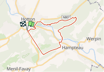
Hotton Rocher +Grotte Aïve

thomarche
User

Length
7.2 km

Max alt
272 m

Uphill gradient
198 m
Km-Effort
9.8 km

Min alt
175 m

Downhill gradient
194 m
Boucle
Yes
Creation date :
2022-03-04 10:14:50.0
Updated on :
2022-03-04 13:43:22.263
2h27
Difficulty : Very easy

FREE GPS app for hiking
 SityTrail
IGN / Geographical institutes
SityTrail Plus
The world is yours!
About
Trail Walking of 7.2 km to be discovered at Wallonia, Luxembourg, Hotton. This trail is proposed by thomarche.
Description
Belle boucle. Mais pause à midi et oublié remettre en route la fin dc manque 2km...
Positioning
Country:
Belgium
Region :
Wallonia
Department/Province :
Luxembourg
Municipality :
Hotton
Location:
Unknown
Start:(Dec)
Start:(UTM)
674323 ; 5570890 (31U) N.
Comments