


Beauchastel

raygautier
User

Length
27 km

Max alt
557 m

Uphill gradient
717 m
Km-Effort
37 km

Min alt
95 m

Downhill gradient
708 m
Boucle
No
Creation date :
2022-03-06 08:12:43.0
Updated on :
2022-03-06 17:33:31.349
9h19
Difficulty : Very difficult

FREE GPS app for hiking
 SityTrail
IGN / Geographical institutes
SityTrail Plus
The world is yours!
About
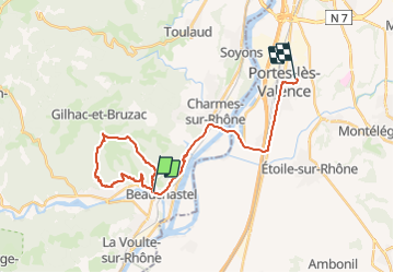
Trail Walking of 27 km to be discovered at Auvergne-Rhône-Alpes, Ardèche, Beauchastel. This trail is proposed by raygautier.
Photos

Positioning
Country:
France
Region :
Auvergne-Rhône-Alpes
Department/Province :
Ardèche
Municipality :
Beauchastel
Location:
Unknown
Start:(Dec)
Start:(UTM)
641961 ; 4965217 (31T) N.
Comments