


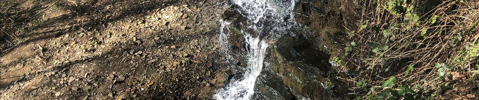
Cascade de CHANXHE 11Km

Efr
User
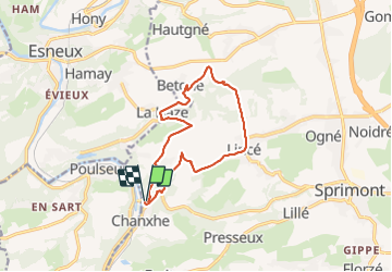

Length
11.4 km

Max alt
283 m

Uphill gradient
311 m
Km-Effort
15.6 km

Min alt
94 m

Downhill gradient
321 m
Boucle
Yes
Creation date :
2022-03-08 09:11:05.0
Updated on :
2022-03-08 20:23:43.874
3h06
Difficulty : Medium

FREE GPS app for hiking
 SityTrail
IGN / Geographical institutes
SityTrail Plus
The world is yours!
About
Trail Walking of 11.4 km to be discovered at Wallonia, Liège, Sprimont. This trail is proposed by Efr.
Description
Depart: Pont de Chanxhe
Photos


Positioning
Country:
Belgium
Region :
Wallonia
Department/Province :
Liège
Municipality :
Sprimont
Location:
Sprimont
Start:(Dec)
Start:(UTM)
684204 ; 5597811 (31U) N.
Comments
Très belle rando avec un peu d asphalte mais sur des routes déserte. En permanence une vision de verdure avec très peu de difficulté si ce n'est les 500 premiers mètres très raides.