


Comps Jabron

avdem
User
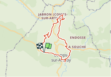

Length
16.6 km

Max alt
1031 m

Uphill gradient
631 m
Km-Effort
25 km

Min alt
784 m

Downhill gradient
630 m
Boucle
Yes
Creation date :
2022-03-08 08:04:00.42
Updated on :
2022-03-08 15:05:58.732
4h45
Difficulty : Very difficult

FREE GPS app for hiking
 SityTrail
IGN / Geographical institutes
SityTrail Plus
The world is yours!
About
Trail Walking of 16.6 km to be discovered at Provence-Alpes-Côte d'Azur, Var, Comps-sur-Artuby. This trail is proposed by avdem.
Description
Sans entrainement assez dur
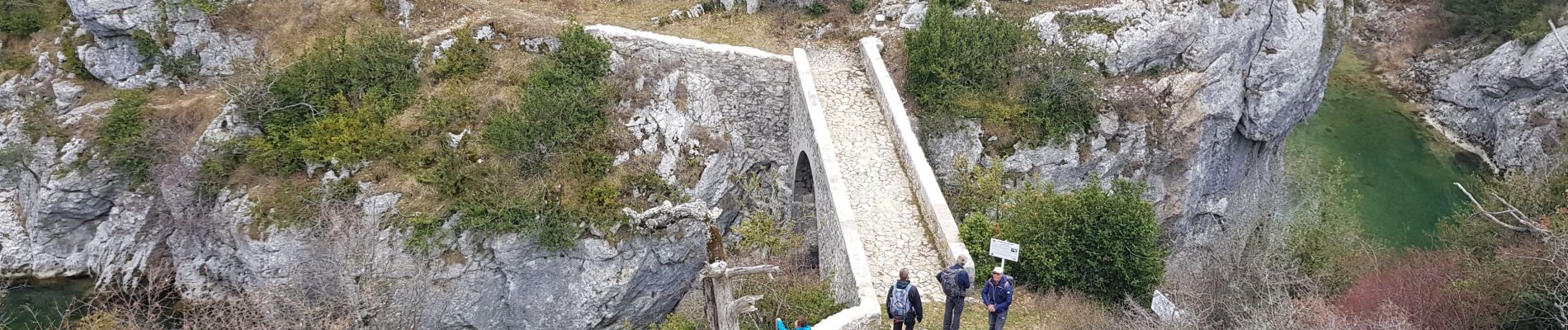
Photos


Positioning
Country:
France
Region :
Provence-Alpes-Côte d'Azur
Department/Province :
Var
Municipality :
Comps-sur-Artuby
Location:
Unknown
Start:(Dec)
Start:(UTM)
297776 ; 4843065 (32T) N.
Comments