


Gg hauteville messigny

coulon
User
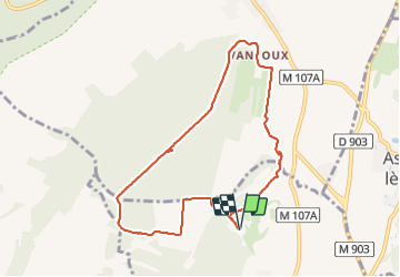

Length
8.3 km

Max alt
395 m

Uphill gradient
139 m
Km-Effort
10.1 km

Min alt
277 m

Downhill gradient
140 m
Boucle
Yes
Creation date :
2022-03-08 13:49:36.0
Updated on :
2022-03-08 16:21:02.163
2h30
Difficulty : Unknown

FREE GPS app for hiking
 SityTrail
IGN / Geographical institutes
SityTrail Plus
The world is yours!
About
Trail Walking of 8.3 km to be discovered at Bourgogne-Franche-Comté, Côte-d'Or, Ahuy. This trail is proposed by coulon.
Description
Hauteville messigny
Positioning
Country:
France
Region :
Bourgogne-Franche-Comté
Department/Province :
Côte-d'Or
Municipality :
Ahuy
Location:
Unknown
Start:(Dec)
Start:(UTM)
652287 ; 5249137 (31T) N.
Comments
a partir du plain d'ahuy il n'y a plus de chemin. clôtures car propriété privée. obligé de rentrer par la route