


Journaux Fraize reconnue

noelphil
User
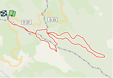

Length
11.5 km

Max alt
806 m

Uphill gradient
376 m
Km-Effort
16.5 km

Min alt
670 m

Downhill gradient
376 m
Boucle
Yes
Creation date :
2022-03-10 08:44:29.383
Updated on :
2022-03-10 11:40:10.098
2h54
Difficulty : Difficult

FREE GPS app for hiking
 SityTrail
IGN / Geographical institutes
SityTrail Plus
The world is yours!
About
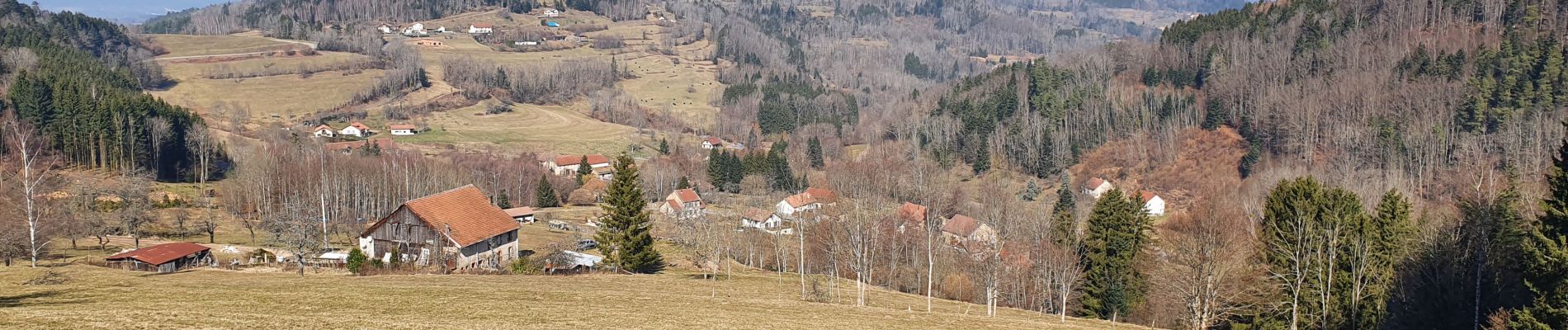
Trail Walking of 11.5 km to be discovered at Grand Est, Vosges, Mandray. This trail is proposed by noelphil.
Photos

Positioning
Country:
France
Region :
Grand Est
Department/Province :
Vosges
Municipality :
Mandray
Location:
Unknown
Start:(Dec)
Start:(UTM)
352245 ; 5340636 (32U) N.
Comments