


venterol

alinetpierre
User
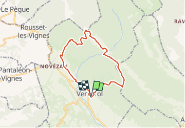

Length
14.1 km

Max alt
710 m

Uphill gradient
557 m
Km-Effort
22 km

Min alt
399 m

Downhill gradient
561 m
Boucle
Yes
Creation date :
2022-03-10 08:33:27.178
Updated on :
2022-03-10 16:23:22.627
3h45
Difficulty : Medium

FREE GPS app for hiking
 SityTrail
IGN / Geographical institutes
SityTrail Plus
The world is yours!
About
Trail Walking of 14.1 km to be discovered at Auvergne-Rhône-Alpes, Drôme, Venterol. This trail is proposed by alinetpierre.
Description
tour du courbiou et de l'oulle
Positioning
Country:
France
Region :
Auvergne-Rhône-Alpes
Department/Province :
Drôme
Municipality :
Venterol
Location:
Unknown
Start:(Dec)
Start:(UTM)
667277 ; 4917034 (31T) N.
Comments