


st Barnabé

Renefrt
User
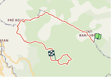

Length
10.2 km

Max alt
1035 m

Uphill gradient
224 m
Km-Effort
13.2 km

Min alt
850 m

Downhill gradient
250 m
Boucle
No
Creation date :
2022-03-10 08:13:49.557
Updated on :
2022-03-12 10:12:37.96
6h11
Difficulty : Easy

FREE GPS app for hiking
 SityTrail
IGN / Geographical institutes
SityTrail Plus
The world is yours!
About
Trail Walking of 10.2 km to be discovered at Provence-Alpes-Côte d'Azur, Maritime Alps, Courmes. This trail is proposed by Renefrt.
Photos


Positioning
Country:
France
Region :
Provence-Alpes-Côte d'Azur
Department/Province :
Maritime Alps
Municipality :
Courmes
Location:
Unknown
Start:(Dec)
Start:(UTM)
342391 ; 4847117 (32T) N.
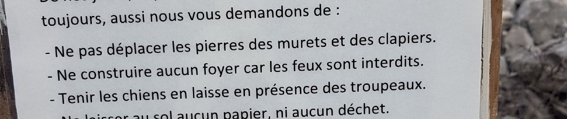
Comments