


SityTrail - sceautres

thonyc
User GUIDE
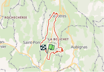

Length
14.8 km

Max alt
553 m

Uphill gradient
533 m
Km-Effort
22 km

Min alt
261 m

Downhill gradient
530 m
Boucle
Yes
Creation date :
2022-03-12 15:50:55.489
Updated on :
2022-03-12 16:45:31.177
4h53
Difficulty : Medium

FREE GPS app for hiking
 SityTrail
IGN / Geographical institutes
SityTrail Plus
The world is yours!
About
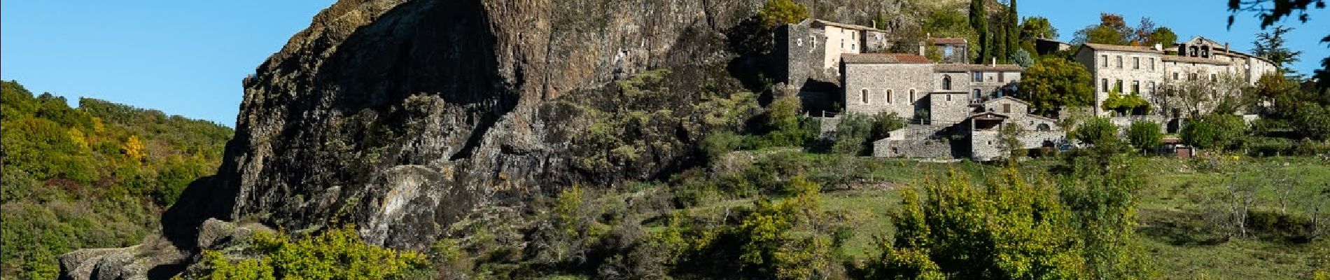
Trail Walking of 14.8 km to be discovered at Auvergne-Rhône-Alpes, Ardèche, Alba-la-Romaine. This trail is proposed by thonyc.
Photos

Positioning
Country:
France
Region :
Auvergne-Rhône-Alpes
Department/Province :
Ardèche
Municipality :
Alba-la-Romaine
Location:
Unknown
Start:(Dec)
Start:(UTM)
626707 ; 4937848 (31T) N.
Comments