


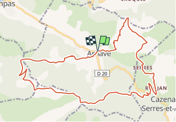
Circuit des quatre cols A- Arnave

c.chehere
User

Length
13.8 km

Max alt
1007 m

Uphill gradient
726 m
Km-Effort
24 km

Min alt
558 m

Downhill gradient
728 m
Boucle
Yes
Creation date :
2022-03-16 07:49:20.936
Updated on :
2022-03-16 08:00:43.799
5h20
Difficulty : Very difficult

FREE GPS app for hiking
 SityTrail
IGN / Geographical institutes
SityTrail Plus
The world is yours!
About
Trail Walking of 13.8 km to be discovered at Occitania, Ariège, Arnave. This trail is proposed by c.chehere.
Positioning
Country:
France
Region :
Occitania
Department/Province :
Ariège
Municipality :
Arnave
Location:
Unknown
Start:(Dec)
Start:(UTM)
389546 ; 4745449 (31T) N.
Comments