


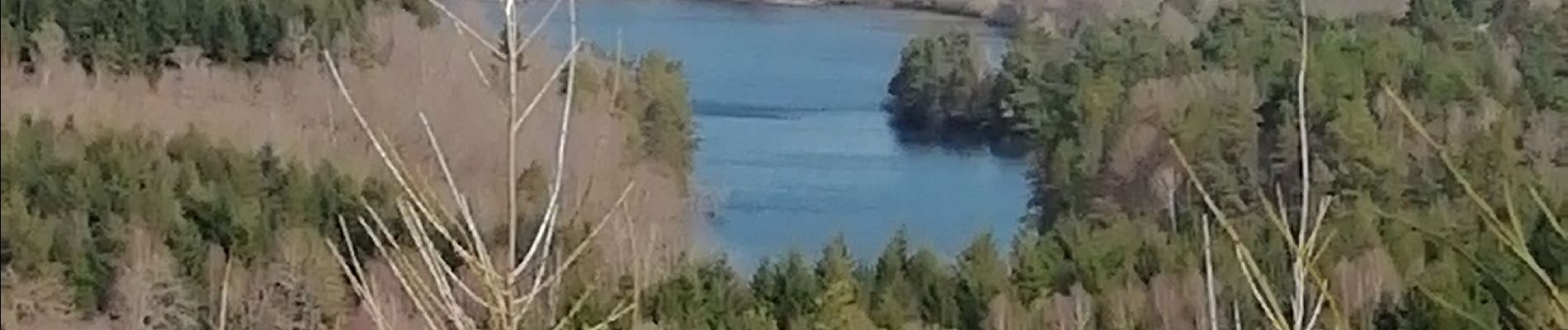
Fred lac du Chammet

arnoultjf
User
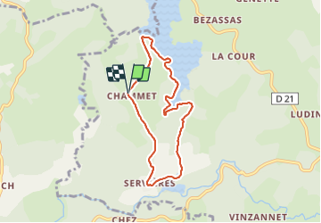

Length
6.7 km

Max alt
808 m

Uphill gradient
154 m
Km-Effort
8.7 km

Min alt
717 m

Downhill gradient
154 m
Boucle
Yes
Creation date :
2022-03-25 09:09:15.183
Updated on :
2022-03-25 11:08:52.54
1h52
Difficulty : Medium

FREE GPS app for hiking
 SityTrail
IGN / Geographical institutes
SityTrail Plus
The world is yours!
About
Trail Walking of 6.7 km to be discovered at New Aquitaine, Corrèze, Peyrelevade. This trail is proposed by arnoultjf.
Description
Moyenne
Photos


Positioning
Country:
France
Region :
New Aquitaine
Department/Province :
Corrèze
Municipality :
Peyrelevade
Location:
Unknown
Start:(Dec)
Start:(UTM)
421056 ; 5062639 (31T) N.
Comments