


rudlin

lepage
User
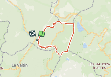

Length
12.5 km

Max alt
1302 m

Uphill gradient
611 m
Km-Effort
21 km

Min alt
715 m

Downhill gradient
618 m
Boucle
Yes
Creation date :
2022-03-25 08:59:19.176
Updated on :
2022-03-25 13:35:26.686
4h35
Difficulty : Difficult

FREE GPS app for hiking
 SityTrail
IGN / Geographical institutes
SityTrail Plus
The world is yours!
About
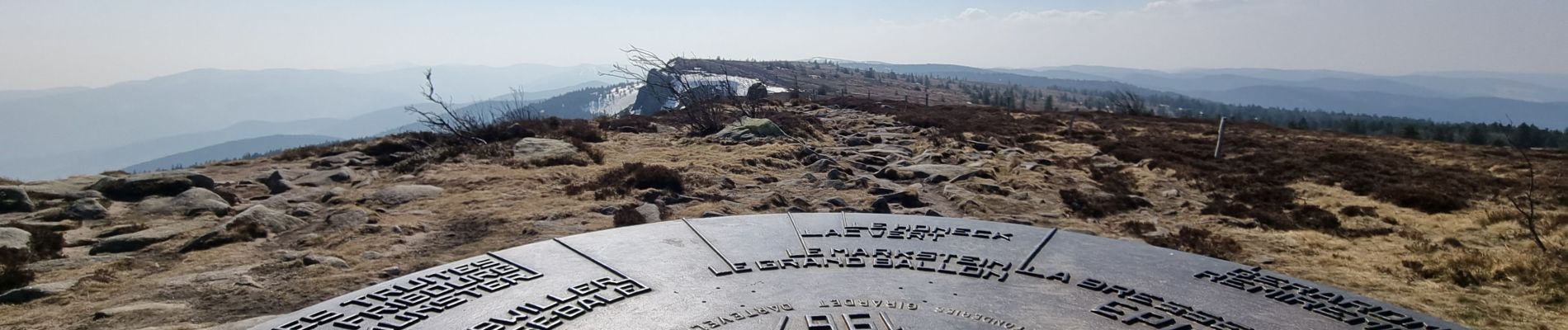
Trail Walking of 12.5 km to be discovered at Grand Est, Vosges, Plainfaing. This trail is proposed by lepage.
Photos


Positioning
Country:
France
Region :
Grand Est
Department/Province :
Vosges
Municipality :
Plainfaing
Location:
Unknown
Start:(Dec)
Start:(UTM)
354396 ; 5331127 (32U) N.
Comments