Trail Walking Montpezat - Balcon de la Vaunage - Montpezat  - Photo

Balcon de la Vaunage - Montpezat

 tracegps
tracegps

User

© OpenStreetMap contributors
Length
Length
14.6 km
Max alt
Max alt
180 m
Uphill gradient
Uphill gradient
305 m
Km-Effort
Km-Effort  
18.7 km
Min alt
Min alt
76 m
Downhill gradient
Downhill gradient
306 m
Boucle
Boucle
Yes
Creation date :
2014-12-10 00:00:00.0
Updated on :
2014-12-10 00:00:00.0

(0 Reviews)

Walking
Walking
3h30
Difficulty : Medium

Scan this QR Code to open this trail in the SityTrail application

FREE GPS app for hiking

Logo SityTrail SityTrail

IGN / Geographical institutes

Download SityTrail from the App Store Download SityTrail from Google Play

Logo SityTrail SityTrail World

The world is yours!

Download SityTrail from the App Store Download SityTrail from Google Play Download SityTrail on Huawei AppGallery

About

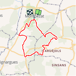
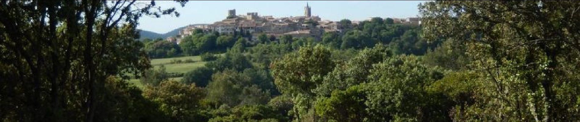
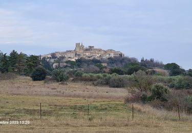
Trail Walking of 14.6 km to be discovered at Occitania, Gard, Montpezat. This trail is proposed by tracegps.

Description

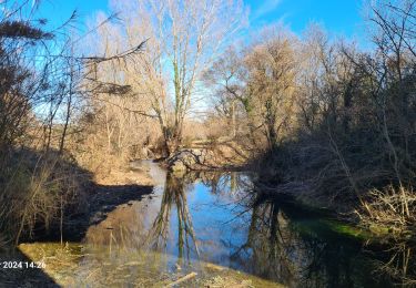
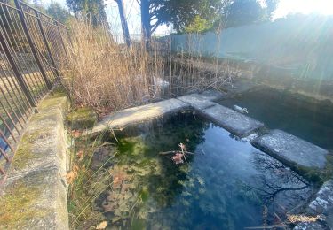
Du parking du village, suivre la rue de Laparant puis à gauche le chemin de Calvisson sur 20m et tourner à droite, et enfin à gauche 200m après, aller visiter les restes d'un moulin et une table d’interprétation du paysage. Prendre la D22 à gauche, traverser le pont et ignorer le balisage jaune qui part à gauche, poursuivre sur la route et tourner à gauche 150 m plus loin (fin d'une haie de cyprès). Cheminer à travers vignes et bosquets jusqu'à St-Etienne d'Escatte pour tourner à gauche avant la sortie du village (ruisseau couvert) et gagner la combe Monier, belle capitelle au passage avant de déboucher sur un bon chemin en crête avec une belle vue sur la plaine de la Vaunage. Prendre à gauche pour rejoindre une route (D103) que l'on va prendre à droite avant de la quitter à gauche par un sentier caillouteux qui descend pour arriver à la source de Fontaran (bel aménagement pour le pique-nique). Après une centaine de mètres, monter à gauche (balisage jaune) puis suivre un DFCI qui fait le tour du Pic Méjean avec une superbe vue sur St Come, Clarensac et Calvisson etc... Suivre le balisage qui retourne sur Montpezat, beau lavoir au passage. Bonne rando.

Elevation profile

Photos

Positioning

Country:
France
Region :
Occitania
Department/Province :
Gard
Municipality :
Montpezat
Location:
Unknown
Start:(UTM)
593029 ; 4855963 (31T) N.

Trails nearby

Trail Walking Saint-Côme-et-Maruéjols - St côtés et maruejols - Photo
Walking
poisson1103

Walking

Very easy
(1)
Saint-Côme-et-Maruéjols, Occitania, Gard, France
13.8 km | 17.2 km-effort
5h 30min
Yes
Trail Walking Parignargues - Parignargues_ST_Mamert_Fons_Gagan - Photo
Walking
v.rabot

Walking

Medium
Parignargues, Occitania, Gard, France
14.4 km | 16.3 km-effort
4h 46min
Yes
Trail Walking Souvignargues - Saint Étienne d’Escattes - Photo
Walking
GUIDE
Roger Philippe Wallez

Walking

Very difficult
Souvignargues, Occitania, Gard, France
16.9 km | 22 km-effort
4h 58min
Yes
Trail Walking Combas - Combats Montpezat - Photo
Walking
v.rabot

Walking

Difficult
Combas, Occitania, Gard, France
14.2 km | 17.4 km-effort
3h 57min
Yes
Trail Walking Combas - Combas - Photo
Walking
guyzinz

Walking

Very difficult
Combas, Occitania, Gard, France
16.6 km | 22 km-effort
6h 8min
Yes
Trail Walking Gajan - Rando1 - Photo
Walking
selleck

Walking

Medium
(1)
Gajan, Occitania, Gard, France
10 km | 12.2 km-effort
2h 0min
Yes
Trail Walking Gajan - Plan Rougé2 - Photo
Walking
selleck

Walking

Easy
(1)
Gajan, Occitania, Gard, France
10.9 km | 13.4 km-effort
2h 53min
Yes
Trail Walking Gajan - Mas des Crottes - Photo
Walking
selleck

Walking

Easy
(1)
Gajan, Occitania, Gard, France
13.1 km | 15.7 km-effort
3h 34min
Yes
Trail Walking Gajan - La Rouveyrolle 2 - Photo
Walking
selleck

Walking

Medium
(1)
Gajan, Occitania, Gard, France
12.5 km | 15.2 km-effort
2h 37min
Yes


Close
My subscriptions