


Aurel

raygautier
User
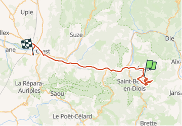

Length
49 km

Max alt
1178 m

Uphill gradient
988 m
Km-Effort
63 km

Min alt
168 m

Downhill gradient
1281 m
Boucle
No
Creation date :
2022-03-24 07:34:14.0
Updated on :
2022-03-26 07:13:21.278
8h37
Difficulty : Very difficult

FREE GPS app for hiking
 SityTrail
IGN / Geographical institutes
SityTrail Plus
The world is yours!
About
Trail Walking of 49 km to be discovered at Auvergne-Rhône-Alpes, Drôme, Aurel. This trail is proposed by raygautier.
Positioning
Country:
France
Region :
Auvergne-Rhône-Alpes
Department/Province :
Drôme
Municipality :
Aurel
Location:
Unknown
Start:(Dec)
Start:(UTM)
682191 ; 4949935 (31T) N.
Comments