


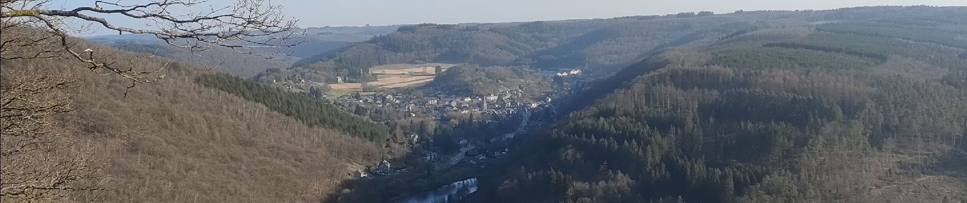
Vresse-sur-Semois

Veroz
User

Length
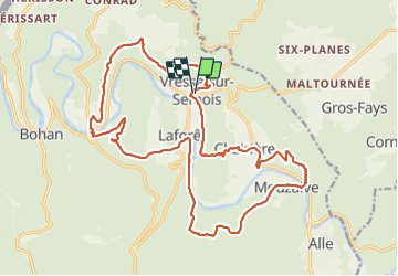
22 km

Max alt
366 m

Uphill gradient
795 m
Km-Effort
33 km

Min alt
175 m

Downhill gradient
797 m
Boucle
Yes
Creation date :
2022-03-26 09:13:15.597
Updated on :
2022-03-26 17:36:50.116
7h04
Difficulty : Difficult

FREE GPS app for hiking
 SityTrail
IGN / Geographical institutes
SityTrail Plus
The world is yours!
About
Trail Walking of 22 km to be discovered at Wallonia, Namur, Vresse-sur-Semois. This trail is proposed by Veroz.
Photos


Positioning
Country:
Belgium
Region :
Wallonia
Department/Province :
Namur
Municipality :
Vresse-sur-Semois
Location:
Unknown
Start:(Dec)
Start:(UTM)
638932 ; 5526241 (31U) N.
Comments