


2022 03 MENNECY T1

michel1025
User
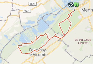

Length
10.7 km

Max alt
93 m

Uphill gradient
100 m
Km-Effort
12 km

Min alt
48 m

Downhill gradient
98 m
Boucle
Yes
Creation date :
2022-03-27 13:17:41.0
Updated on :
2022-03-27 16:04:20.28
2h46
Difficulty : Medium

FREE GPS app for hiking
 SityTrail
IGN / Geographical institutes
SityTrail Plus
The world is yours!
About
Trail Walking of 10.7 km to be discovered at Ile-de-France, Essonne, Mennecy. This trail is proposed by michel1025.
Positioning
Country:
France
Region :
Ile-de-France
Department/Province :
Essonne
Municipality :
Mennecy
Location:
Unknown
Start:(Dec)
Start:(UTM)
457419 ; 5379434 (31U) N.
Comments