


rocher

JEANPAULVALENTIN
User
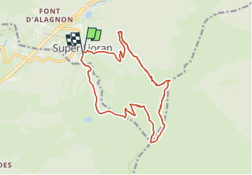

Length
8.6 km

Max alt
1801 m

Uphill gradient
572 m
Km-Effort
16.3 km

Min alt
1236 m

Downhill gradient
574 m
Boucle
Yes
Creation date :
2022-03-30 11:59:13.222
Updated on :
2025-08-09 14:56:53.621
3h42
Difficulty : Difficult

FREE GPS app for hiking
 SityTrail
IGN / Geographical institutes
SityTrail Plus
The world is yours!
About
Trail Walking of 8.6 km to be discovered at Auvergne-Rhône-Alpes, Cantal, Laveissière. This trail is proposed by JEANPAULVALENTIN.
Positioning
Country:
France
Region :
Auvergne-Rhône-Alpes
Department/Province :
Cantal
Municipality :
Laveissière
Location:
Unknown
Start:(Dec)
Start:(UTM)
480300 ; 4992174 (31T) N.
Comments