


2022-03-31_07h38m40_TP_32_km_Michel-14036415-1648705002-661

sterdyniak
User
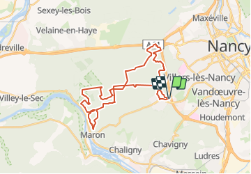

Length
32 km

Max alt
376 m

Uphill gradient
693 m
Km-Effort
41 km

Min alt
244 m

Downhill gradient
691 m
Boucle
Yes
Creation date :
2022-03-31 05:38:41.119
Updated on :
2022-03-31 05:38:40.808

FREE GPS app for hiking
 SityTrail
IGN / Geographical institutes
SityTrail Plus
The world is yours!
About
Trail of 32 km to be discovered at Grand Est, Meurthe-et-Moselle, Villers-lès-Nancy. This trail is proposed by sterdyniak.
Positioning
Country:
France
Region :
Grand Est
Department/Province :
Meurthe-et-Moselle
Municipality :
Villers-lès-Nancy
Location:
Unknown
Start:(Dec)
Start:(UTM)
288226 ; 5393563 (32U) N.
Comments