


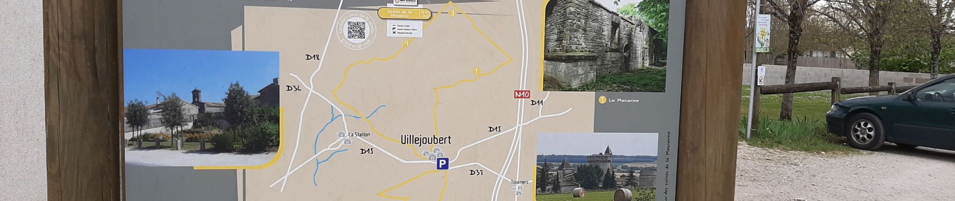
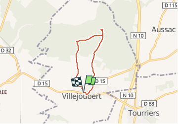
De Villejoubert à la Macarine

alainjoseph6
User

Length
4.9 km

Max alt
134 m

Uphill gradient
54 m
Km-Effort
5.7 km

Min alt
100 m

Downhill gradient
55 m
Boucle
Yes
Creation date :
2022-03-31 12:05:00.774
Updated on :
2022-03-31 13:57:17.509
1h51
Difficulty : Easy

FREE GPS app for hiking
 SityTrail
IGN / Geographical institutes
SityTrail Plus
The world is yours!
About
Trail Walking of 4.9 km to be discovered at New Aquitaine, Charente, Villejoubert. This trail is proposed by alainjoseph6.
Description
Balade très sympa avec la découverte de la Macarine
Photos


Positioning
Country:
France
Region :
New Aquitaine
Department/Province :
Charente
Municipality :
Villejoubert
Location:
Unknown
Start:(Dec)
Start:(UTM)
280396 ; 5076090 (31T) N.
Comments