![](/images/other/stat-length.png)
![Trail Walking L'Isle-Adam - Le tour du Grand Paris via le GR1 - ETAPE 6 de L'isle Adam à Viarmes - Photo](https://media.geolcdn.com/t/1900/400/ext.pjpeg?maxdim=2&url=https%3A%2F%2Fmedia.geolcdn.com%2Ff%2F36124db9-71e6-43bc-985e-e2ee8f4439b2.jpg)
Le tour du Grand Paris via le GR1 - ETAPE 6 de L'isle Adam à Viarmes
chessyca
User
![Length](/images/other/stat-length.png)
Length
28 km
![Max alt](https://static1.geolcdn.com/siteimages/upload/files/1508320355ic_sort_altitude_max_24dp.png)
Max alt
217 m
![Uphill gradient](https://static1.geolcdn.com/siteimages/upload/files/1508320355ic_sort_den_pos_24dp.png)
Uphill gradient
634 m
![Km-Effort](/images/other/stat-length.png)
Km-Effort
36 km
![Min alt](https://static1.geolcdn.com/siteimages/upload/files/1508320355ic_sort_altitude_min_24dp.png)
Min alt
22 m
![Downhill gradient](https://static1.geolcdn.com/siteimages/upload/files/1508320355ic_sort_den_neg_24dp.png)
Downhill gradient
544 m
![Boucle](https://static1.geolcdn.com/siteimages/upload/files/16400158638029165_repeat_loop_refresh_sync_direction_icon.png)
Boucle
No
Creation date :
2022-03-31 07:21:11.0
Updated on :
2024-06-16 16:11:39.958
![Walking](https://static1.geolcdn.com/sitytour/trail-icons/101.png)
5h01
Difficulty : Medium
![Scan this QR Code to open this trail in the SityTrail application](https://capi.geolives.com/qq0zvz2zws4bq2lad0pu/sitytour/trails/3187428/qr.png?size=200)
FREE GPS app for hiking
About
Trail Walking of 28 km to be discovered at Ile-de-France, Val-d'Oise, L'Isle-Adam. This trail is proposed by chessyca.
Description
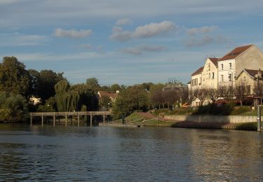
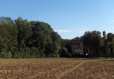
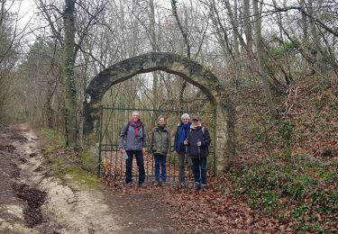
De l'Isle Adam à Viarmes
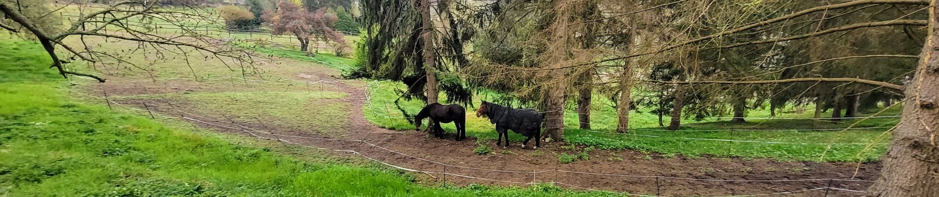
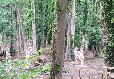
Forêt de L'isle Adam et Carnelle vraiment magnifiques
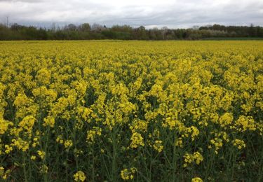
Petits villages ravissants à souhait
Positioning
Country:
France
Region :
Ile-de-France
Department/Province :
Val-d'Oise
Municipality :
L'Isle-Adam
Location:
Unknown
Start:(Dec)
Start:(UTM)
442692 ; 5440255 (31U) N.
Comments
Trails nearby
![Trail Walking Parmain - L Parmain jean Sarment a Valmondoit - Photo](https://media.geolcdn.com/t/375/260/ext.jpg?maxdim=2&url=https%3A%2F%2Fmedia.geolcdn.com%2Ff%2Ff077cbce-67ad-4318-aa64-96311b6a86ee.jpg)
![Walking Walking](https://static1.geolcdn.com/sitytour/trail-icons/101.png)
L Parmain jean Sarment a Valmondoit
Walking
Very easy
(1)
Parmain,
Ile-de-France,
Val-d'Oise,
France
![](/images/other/stat-length.png)
7.9 km | 9.5 km-effort
2h 10min
![](https://static1.geolcdn.com/siteimages/upload/files/16400158638029165_repeat_loop_refresh_sync_direction_icon.png)
Yes
![Trail Walking Presles - autour de Presles - Photo](https://media.geolcdn.com/t/375/260/ext.jpg?maxdim=2&url=https%3A%2F%2Fservices.sitytrail.com%2FGeolivesWS%2FDownloadMedia.ashx%3FTrailID%3D263831%26Media%3D20140406161403.jpg)
![Walking Walking](https://static1.geolcdn.com/sitytour/trail-icons/101.png)
autour de Presles
Walking
Easy
(2)
Presles,
Ile-de-France,
Val-d'Oise,
France
![](/images/other/stat-length.png)
9 km | 10.4 km-effort
1h 48min
![](https://static1.geolcdn.com/siteimages/upload/files/16400158638029165_repeat_loop_refresh_sync_direction_icon.png)
Yes
![Trail Walking L'Isle-Adam - Autour de l'Isle Adam - Photo](https://media.geolcdn.com/t/375/260/ext.jpg?maxdim=2&url=https%3A%2F%2Fservices.sitytrail.com%2FGeolivesWS%2FDownloadMedia.ashx%3FTrailID%3D110076%26Media%3D5235_1.jpg)
![Walking Walking](https://static1.geolcdn.com/sitytour/trail-icons/101.png)
Autour de l'Isle Adam
Walking
Difficult
(1)
L'Isle-Adam,
Ile-de-France,
Val-d'Oise,
France
![](/images/other/stat-length.png)
22 km | 26 km-effort
4h 30min
![](https://static1.geolcdn.com/siteimages/upload/files/16400158638029165_repeat_loop_refresh_sync_direction_icon.png)
Yes
![Trail Walking Valmondois - Vallée de Nesles - Photo](https://media.geolcdn.com/t/375/260/ext.jpg?maxdim=2&url=https%3A%2F%2Fservices.sitytrail.com%2FGeolivesWS%2FDownloadMedia.ashx%3FTrailID%3D110075%26Media%3D5234_1.jpg)
![Walking Walking](https://static1.geolcdn.com/sitytour/trail-icons/101.png)
Vallée de Nesles
Walking
Difficult
(1)
Valmondois,
Ile-de-France,
Val-d'Oise,
France
![](/images/other/stat-length.png)
23 km | 28 km-effort
4h 45min
![](https://static1.geolcdn.com/siteimages/upload/files/16400158638029165_repeat_loop_refresh_sync_direction_icon.png)
Yes
![Trail On foot L'Isle-Adam - L'Isle-Adam 02 L'Isle Adam - Photo](https://media.geolcdn.com/t/375/260/ext.jpg?maxdim=2&url=https%3A%2F%2Fstatic1.geolcdn.com%2Fsiteimages%2Fupload%2Ffiles%2F1545311037marcheuse_200dpi.jpg)
![On foot On foot](https://static1.geolcdn.com/sitytour/trail-icons/100.png)
L'Isle-Adam 02 L'Isle Adam
On foot
Very easy
(1)
L'Isle-Adam,
Ile-de-France,
Val-d'Oise,
France
![](/images/other/stat-length.png)
9.4 km | 10.7 km-effort
3h 0min
![](https://static1.geolcdn.com/siteimages/upload/files/16400158638029165_repeat_loop_refresh_sync_direction_icon.png)
Yes
![Trail Walking Champagne-sur-Oise - Autour de Parmain - Photo](https://media.geolcdn.com/t/375/260/ext.jpg?maxdim=2&url=https%3A%2F%2Fstatic1.geolcdn.com%2Fsiteimages%2Fupload%2Ffiles%2F1553511878bg_sport_marche.png)
![Walking Walking](https://static1.geolcdn.com/sitytour/trail-icons/101.png)
Autour de Parmain
Walking
Medium
(1)
Champagne-sur-Oise,
Ile-de-France,
Val-d'Oise,
France
![](/images/other/stat-length.png)
18.9 km | 23 km-effort
4h 0min
![](https://static1.geolcdn.com/siteimages/upload/files/16400158638029165_repeat_loop_refresh_sync_direction_icon.png)
No
![Trail Walking Champagne-sur-Oise - Vaux Chateaude Chambly Ronquerole - Photo](https://media.geolcdn.com/t/375/260/ext.jpg?maxdim=2&url=https%3A%2F%2Fmedia.geolcdn.com%2Ff%2Fcbee2e0f-c40e-40ad-a67b-eb4ac34cdc7c.jpg)
![Walking Walking](https://static1.geolcdn.com/sitytour/trail-icons/101.png)
Vaux Chateaude Chambly Ronquerole
Walking
Easy
Champagne-sur-Oise,
Ile-de-France,
Val-d'Oise,
France
![](/images/other/stat-length.png)
10.6 km | 13.1 km-effort
2h 28min
![](https://static1.geolcdn.com/siteimages/upload/files/16400158638029165_repeat_loop_refresh_sync_direction_icon.png)
Yes
![Trail Walking Valmondois - Valmondois Mesles - Photo](https://media.geolcdn.com/t/375/260/ext.jpg?maxdim=2&url=https%3A%2F%2Fmedia.geolcdn.com%2Ff%2F47035f7e-0b70-46b5-a0f2-a695d19358e8.jpg)
![Walking Walking](https://static1.geolcdn.com/sitytour/trail-icons/101.png)
Valmondois Mesles
Walking
Easy
Valmondois,
Ile-de-France,
Val-d'Oise,
France
![](/images/other/stat-length.png)
11 km | 13.6 km-effort
2h 42min
![](https://static1.geolcdn.com/siteimages/upload/files/16400158638029165_repeat_loop_refresh_sync_direction_icon.png)
Yes
![Trail Walking Parmain - Hedouville Frouville Nesle la Valee - Photo](https://media.geolcdn.com/t/375/260/ext.jpg?maxdim=2&url=https%3A%2F%2Fmedia.geolcdn.com%2Ff%2F9eeebc22-b55d-42f0-8f5a-263063b7a7b5.jpg)
![Walking Walking](https://static1.geolcdn.com/sitytour/trail-icons/101.png)
Hedouville Frouville Nesle la Valee
Walking
Very easy
Parmain,
Ile-de-France,
Val-d'Oise,
France
![](/images/other/stat-length.png)
14.7 km | 17.7 km-effort
3h 30min
![](https://static1.geolcdn.com/siteimages/upload/files/16400158638029165_repeat_loop_refresh_sync_direction_icon.png)
Yes