


Einrhur 23 km

rvapeldo
User GUIDE
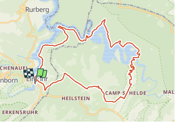

Length
23 km

Max alt
525 m

Uphill gradient
477 m
Km-Effort
29 km

Min alt
280 m

Downhill gradient
476 m
Boucle
Yes
Creation date :
2022-04-03 08:17:10.0
Updated on :
2022-04-03 18:03:19.075
7h51
Difficulty : Medium

FREE GPS app for hiking
 SityTrail
IGN / Geographical institutes
SityTrail Plus
The world is yours!
About
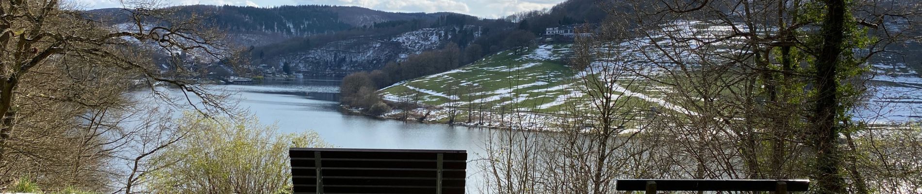
Trail Walking of 23 km to be discovered at North Rhine-Westphalia, Städteregion Aachen, Simmerath. This trail is proposed by rvapeldo.
Photos


24 photos in total. Please click on a photo to see them all in the gallery.
Positioning
Country:
Germany
Region :
North Rhine-Westphalia
Department/Province :
Städteregion Aachen
Municipality :
Simmerath
Location:
Unknown
Start:(Dec)
Start:(UTM)
314504 ; 5606509 (32U) N.
Comments