


olloy sur viroin 030422

guyernage25
User
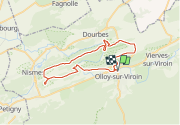

Length
15 km

Max alt
250 m

Uphill gradient
317 m
Km-Effort
19.2 km

Min alt
137 m

Downhill gradient
316 m
Boucle
Yes
Creation date :
2022-04-03 10:30:21.415
Updated on :
2022-04-03 19:42:42.232
3h55
Difficulty : Medium

FREE GPS app for hiking
 SityTrail
IGN / Geographical institutes
SityTrail Plus
The world is yours!
About
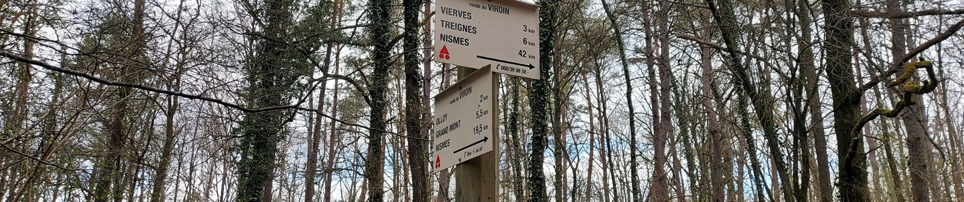
Trail Walking of 15 km to be discovered at Wallonia, Namur, Viroinval. This trail is proposed by guyernage25.
Description
belle rando sur la Calestienne
Photos


Positioning
Country:
Belgium
Region :
Wallonia
Department/Province :
Namur
Municipality :
Viroinval
Location:
Unknown
Start:(Dec)
Start:(UTM)
614970 ; 5548221 (31U) N.
Comments