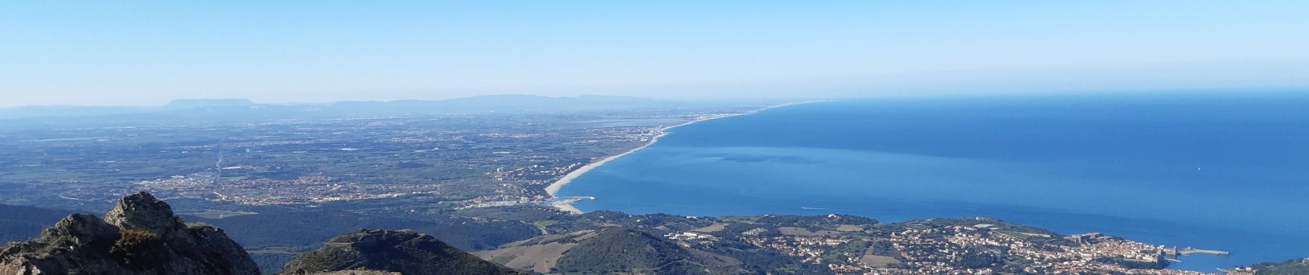
MADELOC depuis col de la serra, via col formigo, batterie 500, madeloc, col tellaferra

stef789
User GUIDE
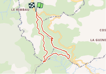

Length
9 km

Max alt
637 m

Uphill gradient
423 m
Km-Effort
14.6 km

Min alt
325 m

Downhill gradient
420 m
Boucle
Yes
Creation date :
2022-04-05 12:03:57.083
Updated on :
2022-04-05 16:51:08.245
4h45
Difficulty : Difficult

FREE GPS app for hiking
 SityTrail
IGN / Geographical institutes
SityTrail Plus
The world is yours!
About
Trail Walking of 9 km to be discovered at Occitania, Pyrénées-Orientales, Collioure. This trail is proposed by stef789.
Photos


Positioning
Country:
France
Region :
Occitania
Department/Province :
Pyrénées-Orientales
Municipality :
Collioure
Location:
Unknown
Start:(Dec)
Start:(UTM)
505342 ; 4705834 (31T) N.
Comments