


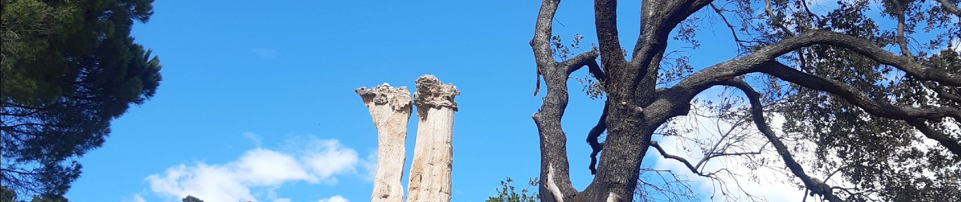
les Orgues - Ille-sur-Tet

stef789
User GUIDE
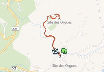

Length
2 km

Max alt
182 m

Uphill gradient
41 m
Km-Effort
2.6 km

Min alt
138 m

Downhill gradient
41 m
Boucle
Yes
Creation date :
2022-04-06 14:30:49.502
Updated on :
2022-04-06 15:34:33.509
1h03
Difficulty : Very easy

FREE GPS app for hiking
 SityTrail
IGN / Geographical institutes
SityTrail Plus
The world is yours!
About
Trail Walking of 2 km to be discovered at Occitania, Pyrénées-Orientales, Ille-sur-Têt. This trail is proposed by stef789.
Photos


Positioning
Country:
France
Region :
Occitania
Department/Province :
Pyrénées-Orientales
Municipality :
Ille-sur-Têt
Location:
Unknown
Start:(Dec)
Start:(UTM)
469031 ; 4725527 (31T) N.
Comments
Merci pour ces belles photos.