


Wagnelée - Wayaux - Heppignies - Villers Perwin

philadelphie
User
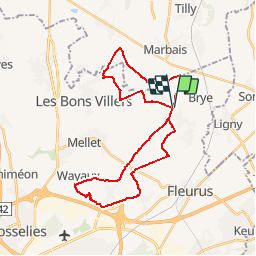

Length
29 km

Max alt
176 m

Uphill gradient
214 m
Km-Effort
32 km

Min alt
136 m

Downhill gradient
215 m
Boucle
Yes
Creation date :
2014-12-10 00:00:00.0
Updated on :
2014-12-10 00:00:00.0
4h03
Difficulty : Medium

FREE GPS app for hiking
 SityTrail
IGN / Geographical institutes
SityTrail Plus
The world is yours!
About
Trail Equestrian of 29 km to be discovered at Wallonia, Hainaut, Fleurus. This trail is proposed by philadelphie.

Positioning
Country:
Belgium
Region :
Wallonia
Department/Province :
Hainaut
Municipality :
Fleurus
Location:
Wagnelée
Start:(Dec)
Start:(UTM)
609069 ; 5597514 (31U) N.
Comments