


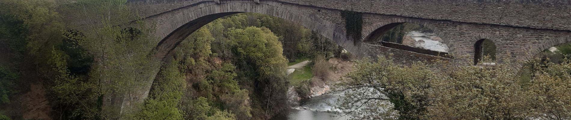
Céret pont du Diable . Saint Feriol (boucle sens aiguilles de la montre)

stef789
User GUIDE
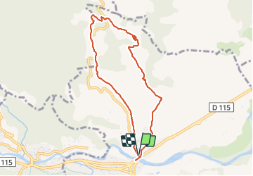

Length
8.5 km

Max alt
336 m

Uphill gradient
252 m
Km-Effort
11.9 km

Min alt
124 m

Downhill gradient
261 m
Boucle
Yes
Creation date :
2022-04-08 13:36:53.874
Updated on :
2022-04-08 17:22:41.257
3h44
Difficulty : Easy

FREE GPS app for hiking
 SityTrail
IGN / Geographical institutes
SityTrail Plus
The world is yours!
About
Trail Walking of 8.5 km to be discovered at Occitania, Pyrénées-Orientales, Céret. This trail is proposed by stef789.
Photos
 - Photo 1")
 - Photo 2")
 - Photo 3")
 - Photo 4")
 - Photo 5")
 - Photo 6")
 - Photo 7")
 - Photo 8")
 - Photo 9")
 - Photo 10")
 - Photo 11")
 - Photo 12")
 - Photo 13")
 - Photo 14")
Positioning
Country:
France
Region :
Occitania
Department/Province :
Pyrénées-Orientales
Municipality :
Céret
Location:
Unknown
Start:(Dec)
Start:(UTM)
478993 ; 4704905 (31T) N.
Comments
circuit effectué en sens inverse comme le préconise le guide Chamina. De beaux paysages et un aspect historique intéressant.